Sátoraljaújhely (Sátoraljaújhelyi járás)
Sátoraljaújhely (archaic Neustadt am Zeltberg ; Nové Mesto pod Šiatrom; איהעל, or אוהעלי) is a town located in Borsod-Abaúj-Zemplén county in northern Hungary along the Slovak border. It is 82 km east from the county capital Miskolc.
Sátor-alja (meaning "under the tent", referring to the tent-shaped mountain nearby) was a settlement from the Hungarian conquest of the Carpathian Basin until it was destroyed during the First Mongol invasion of Hungary. It was rebuilt in the 13th century, although there was disagreement among the citizens concerning the name: some wanted to keep the original name, and some wanted to rename it új hely ("new place"). Sátoraljaújhely was granted town status in 1261 by King Stephen V, and a castle was also built around that time.
Sátoraljaújhely has often played an important role in the region's history: revolts against Habsburg rule began there in the 17th and 18th centuries. After the Revolution of 1848, Sátoraljaújhely developed rapidly owing to its location close to important trade routes leading to Poland, Ruthenia, and Transylvania. The town's light industry led to it becoming the capital of the comitatus (county) of Zemplén in the 17th century.
Sátoraljaújhely has always been an important town in culture. Ferenc Kazinczy, one of the reformers of the Hungarian language, lived here in the 18th century. At the turn of the 20th century the town was home to a small but important Jewish community: some 4,500 of the town's 13,000 residents were Jewish. The community counted among its members Moses Teitelbaum and Michael Heilprin.
Under the Treaty of Trianon, Hungary lost its northern territories. The border was set at the Ronyva stream, splitting the city into two parts. One-fifth of the population and one-fourth of the territory of the town became part of Czechoslovakia. The newly created village got the name of Slovenské Nové Mesto ("Slovak new town") in Slovak; Szlovákújhely ("Slovak new town") or Kisújhely ("Little new town") in Hungarian. Two railway lines and the industrial zone were lost to Hungary. The town's industry was being rebuilt during the interwar period, but the outbreak of World War II disrupted this development. Nazi repression, continuous bombing after 1943, the killing of most of its Jewish population (most were forcibly sent to Auschwitz) and finally the Soviet occupation left the town in a very poor condition.
During the reorganisation of administration in 1950, the former comitatus of Zemplén became part of the united Borsod-Abaúj-Zemplén county, and Sátoraljaújhely lost its county capital status.
Sátoraljaújhely was rebuilt again and is today a national ski centre and tourism destination.
Map - Sátoraljaújhely (Sátoraljaújhelyi járás)
Map
Country - Hungary
 |
 |
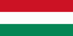
| Flag of Hungary | |
The territory of present-day Hungary has for centuries been a crossroads for various peoples, including Celts, Romans, Germanic tribes, Huns, West Slavs and the Avars. The foundation of the Hungarian state was established in the late 9th century AD with the conquest of the Carpathian Basin by Hungarian grand prince Árpád. His great-grandson Stephen I ascended the throne in 1000, converting his realm to a Christian kingdom. By the 12th century, Hungary became a regional power, reaching its cultural and political height in the 15th century. Following the Battle of Mohács in 1526, it was partially occupied by the Ottoman Empire (1541–1699). Hungary came under Habsburg rule at the turn of the 18th century, later joining with the Austrian Empire to form Austria-Hungary, a major power into the early 20th century.
Currency / Language
| ISO | Currency | Symbol | Significant figures |
|---|---|---|---|
| HUF | Hungarian forint | Ft | 2 |
| ISO | Language |
|---|---|
| HU | Hungarian language |


